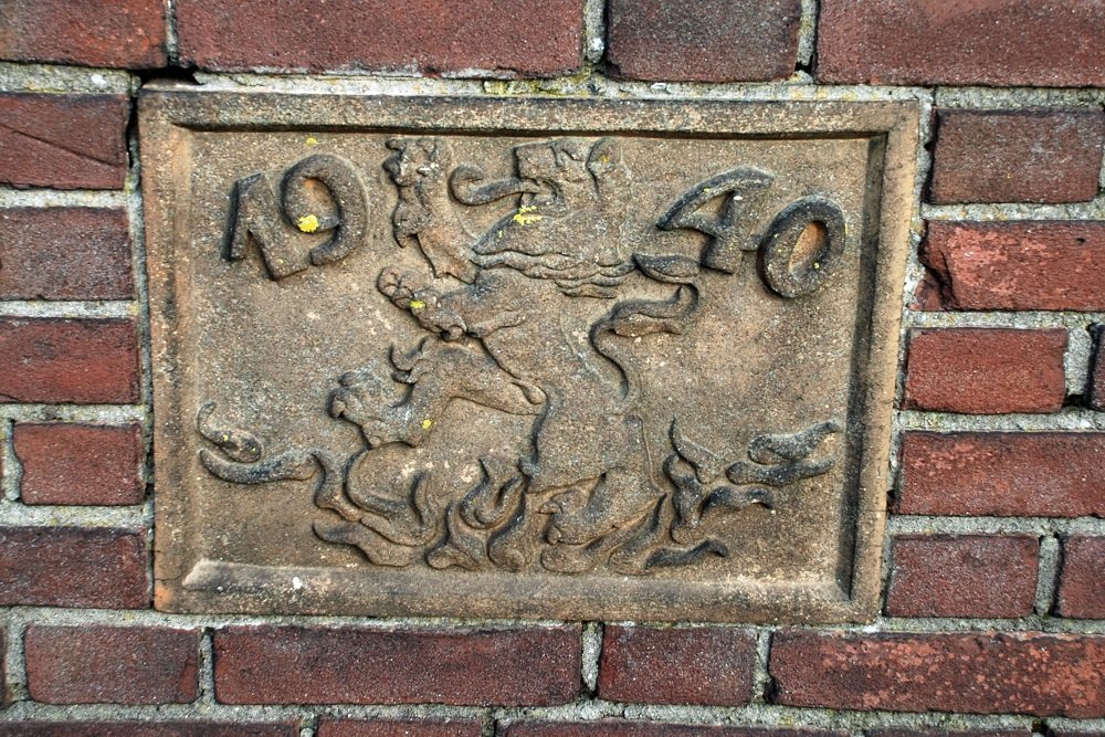
Memorial Stone De Rijzende Leeuw
Facing brick in a farm.
Baarn, with about 13,000 inhabitants at that time, was a defense point in the Grebbe Line from the Lower Rhine at the Grebbeberg via the Eem to the former Zuiderzee, nowadays Gooimeer. The polder on the east side of the Eem was flooded. This "Bunschoterkom" ran via Hoogland to Amersfoort.
The Eembrug on the Bisschopsweg near Baarn was the only bridge in the East-West connection over the Eem between Amersfoort and the then IJsselmeer. To have a better field of fire, a few farms on the Zuidereind were burned down.
This stone, 'the rising lion', still indicates where the farm was burned down.
Do you have more information about this location? Inform us!
Source
- Text: Wim Velthuizen; 1940 - 1945 Baarn in de Tweede Wereldoorlog ... terugblik
- Photos: Eric van der Ent (1), Willem Visser (2, 3)
- WIM VELTHUIZEN, Baarn in de Tweede Wereldoorlog ... terugblik, Groenegraf.nl, Baarn, 2017.
Nearby
Museum
- Historical Collection Signal Corps - Amersfoort
- Dutch Cavalry Museum - Amersfoort
- Museum Spakenburg - Bunschoten-Spakenburg
Point of interest
- Villa Mariaheuvel Baarn - Baarn
- Headquarters Sicherheitsdienst Baarn - Baarn
- Former Bath Hotel Baarn - Baarn
Monument
- Memorial Prins Willem Frederik Baarn - Baarn
- Liberation monument Baarn - Baarn
- Jewish Memorial Baarn - Baarn
Cemetery
- Dutch War Graves New Municipal Cemetery Baarn - Baarn
- Dutch War Graves Roman Catholic Cemetery Baarn - Baarn
- Dutch War Graves Municipal Cemetery Soest - Soest
Remembrance Stone
- Stumbling Stone Prins Bernhardlaan 23 - Soest
- Stumbling Stone Van Straelenlaan 31 - Soest
- Memorial Stone Hamseweg 33 - Hoogland
Fortification
- Grebbe Line - S3a Casemate E16 - Hoogland
- Grebbe Line - SZW Casemate E15 - Hoogland
- Grebbe Line - SZW Casemate E14 - Hoogland


