Bunker Belt Bruggenhoofd Gent – C18

Belgian bunker, part of the Ghent Bridgehead. This defensive position was constructed between 1934 and 1938, eight kilometres south of Ghent. Its construction was part of the fortification policy that Belgium pursued after the First World War.
The actual bridgehead consisted of two resistance nests – Betsberg and Muntekouter – and three strong points – Semmerzake, Eke and Astene.
The resistance nests and strong points were connected to each other by a curtain consisting of three defence lines.
There were 19 bunkers on the Wetteren territory, of which 8 have been demolished. Of the remaining ones, several are on private property or in the industrial zone.
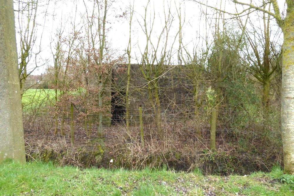
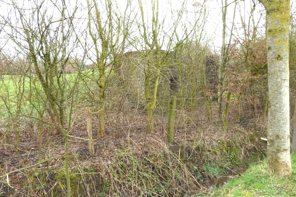
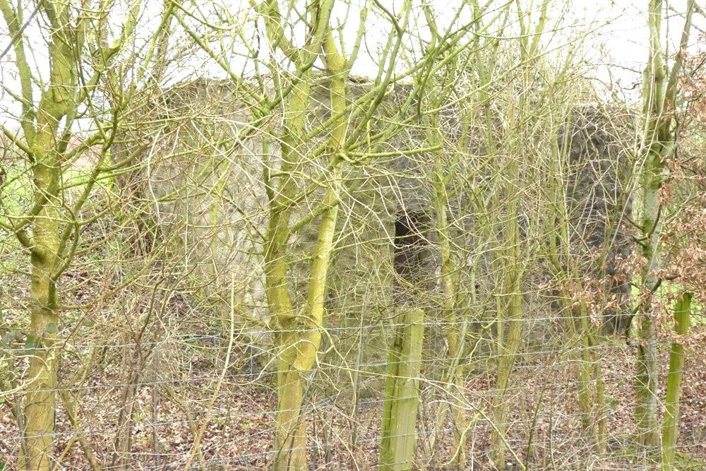
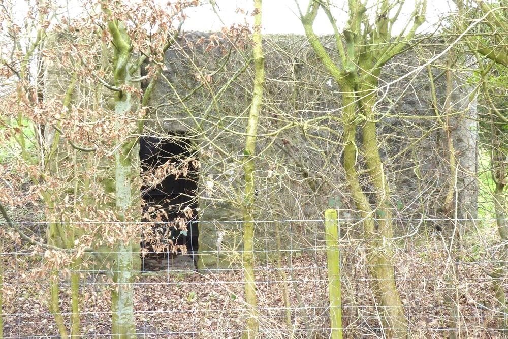
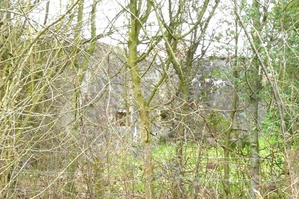
C18 was the last command bunker on the support line between Brussels-Ostend and the Aalst-Ghent road. It was literally on the border of Kwatrecht with Melle.
It was located quite close to D20 (475 m), D21 (185 m) and D22 (225 m) in the railway bridge. It was positioned at an angle to D20 in order to have a larger firing range together.
The bunker had a rough stone appearance and was painted in camouflage colours, shades of green and yellow. It had a fairly large retaining wall. The firing holes were hidden behind metal shutters. At the rear it was hidden in a verge of soil.
It was incorporated into the terrain as much as possible in order not to stand out in the landscape.
It included two rooms connected at the rear and an airlock.
The rooms were only intended for mounting a Maxim machine gun. The bunker was located in the middle of the fighting in May 1940, but no direct traces of the battle are visible.
C18 is located on a meadow along a field road. The path starts at the Kwatrecht viaduct. At the T you turn left, a few hundred meters further it is on the left side of the path behind trees and bushes.
Extensive information about this bunker belt can be found on the site Bunkergordel Bruggenhoofd Gent. It also contains photos, plans and technical data of the bunkers. A map shows the locations per municipality.
Do you have more information about this location? Inform us!
Source
- Text: TracesOfWar
- Photos: Marie-Christine Vinck


Nearby
Museum
Point of interest
- Institute Mariagaard Kwatrecht - Wetteren-Kwatrecht
- College Paters Jozefieten - Melle (Merelbeke-Melle)
- Halve Maanroute – information board 3, Battle of Gijzenzele - Gijzenzele
Monument
- Memorial 5th Line Regiment Kwatrecht - Wetteren
- Memorial 5th Line Regiment Kwatrecht - Wetteren-Kwatrecht
- Memorial Former Students College Melle - Melle (Merelbeke-Melle)
Cemetery
- Belgian War Graves Wetteren-Kwatrecht - Wetteren-Kwatrecht
- Belgian Graves Veterans Gontrode - Gontrode (Merelbeke-Melle)
- Belgian War Graves Wetteren Ten Ede - Wetteren
Remembrance Stone
- Stumbling Stone Stationsstraat 30 - Wichelen
- Stumbling Stone Wettersestraat 25 - Wichelen
- Stumbling Stone Jacques Eggermontstraat 59 - Gent
Fortification
Looking for reliable information or news facts about WW2? Do you want to create your own battlefield tour to sights of wars from the past? Or are you interested in war medals and their recipients? TracesOfWar.com tells you more!
More information

© STIWOT, 1999-2025. All rights reserved. Privacy statement, cookies, disclaimer and copyright