Bunker Belt Bruggenhoofd Gent – Front-line Bunker A36

Belgian bunker, part of the Ghent Bridgehead. This defensive position was constructed between 1934 and 1938, eight kilometres south of Ghent. Its construction was part of the fortification policy that Belgium pursued after the First World War.
The actual bridgehead consisted of two resistance nests – Betsberg and Muntekouter – and three strong points – Semmerzake, Eke and Astene.
The resistance nests and strong points were connected to each other by a curtain consisting of three defence lines.
There are 8 bunkers on the territory of Gijzenzele. Some are on private property and are therefore inaccessible, others are overgrown.
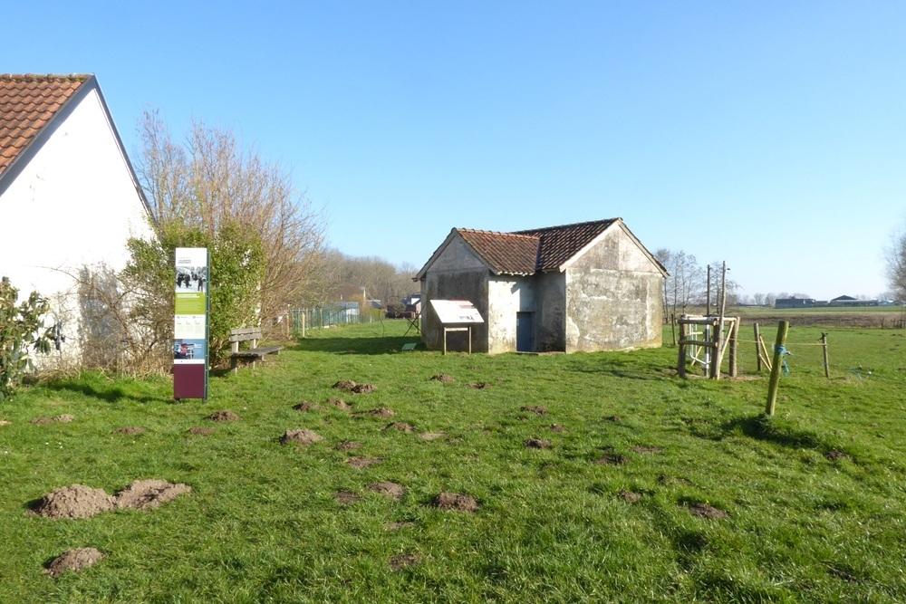
A36 was a front-line bunker between Betsberg and the Ostend-Brussels railway line between A35 (630 m) and A37 (85 m). It fired at the open fields between Wulgenstraat and Gijzenzelestraat in a southerly direction.
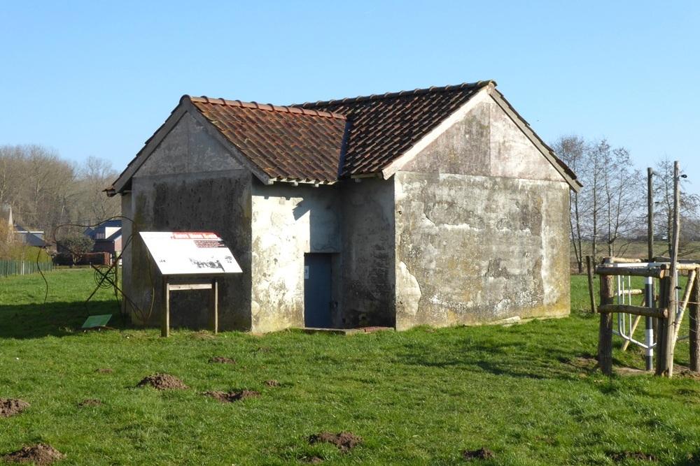
The bunker was cemented and had brick corners. The fairly flat saddle roof was covered with red Boom tiles.
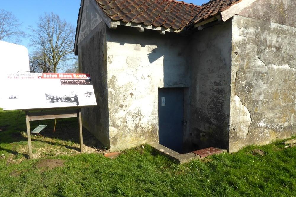
The two loopholes for the machine gun were hidden behind false windows with 2 shutters. The bunker looked like an outbuilding at the last house on the left.
It consisted of two rooms connected at the back and an airlock.
Each room was equipped as standard for setting up Maxim machine guns, but also for setting up Hotchkiss or Colt machine guns.
The bunker is located on the corner of a field, clearly visible along Kerkstraat after the last house on the left.
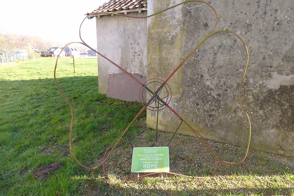
On 20 May 2017, a work of art was inaugurated next to bunker A36.
Pupils from the fourth, fifth and sixth grades of the primary school IZOO Oosterzele made the design, the work of art was realised in collaboration with the Oosterzele artist Jacques Van Den Abeele.
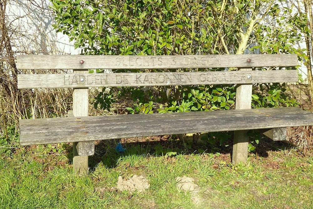
Next to the bunker is a wooden bench with the inscription "Only 3 days have the guns roared ...". There is also the sixth information board of the Halve Maan Route and a testimony of Alma Bernaert, 20 years old in 1940, living near the bunker at the time of the fighting.
Extensive information about this bunker belt can be found on the site Bunkergordel Bruggenhoofd Gent. It also contains photos, plans and technical data of the bunkers. A map shows the locations per municipality.
Do you have more information about this location? Inform us!
Source
- Text: TracesOfWar
- Photos: Marie-Christine Vinck


Nearby
Museum
Point of interest
- Halve Maanroute – information board 6, Battle of Gijzenzele - Gijzenzele
- Peace Tree Gijzenzele - Gijzenzele
- Halve Maanroute – information board 2, Battle of Gijzenzele - Gijzenzele
Monument
- War Memorial Gijzenzele - Gijzenzele (Oosterzele)
- War Memorial Landskouter - Landskouter (Oosterzele)
- Memorial 5th Line Regiment Kwatrecht - Wetteren-Kwatrecht
Cemetery
- Belgian Graves Veterans Gijzenzele - Gijzenzele (Oosterzele)
- Belgian War Grave Belgisch Gijzenzele - Gijzenzele (Oosterzele)
- Commonwealth War Grave Gijzenzele - Gijzenzele (Oosterzele)
Remembrance Stone
- Stumbling Stone Molendijk 20 - Borsbeke (Herzele)
- Stumbling Stone Jacques Eggermontstraat 59 - Gent
- Stumbling Stone Molendijk 30 - Borsbeke (Herzele)
Fortification
Looking for reliable information or news facts about WW2? Do you want to create your own battlefield tour to sights of wars from the past? Or are you interested in war medals and their recipients? TracesOfWar.com tells you more!
More information

© STIWOT, 1999-2025. All rights reserved. Privacy statement, cookies, disclaimer and copyright