Bunker Belt Bruggenhoofd Gent – Front Line Bunker Se11

Belgian bunker, part of the Ghent Bridgehead. This defensive position was constructed between 1934 and 1938, eight kilometres south of Ghent. Its construction was part of the fortification policy that Belgium pursued after the First World War.
The actual bridgehead consisted of two resistance nests – Betsberg and Muntekouter – and three strong points – Semmerzake, Eke and Astene.
The resistance nests and strong points were connected to each other by a curtain consisting of three defence lines.
There were 18 bunkers on the territory of Semmerzake. Three of them have been demolished, one has been dug in. Of the others, some are on private property or are overgrown.
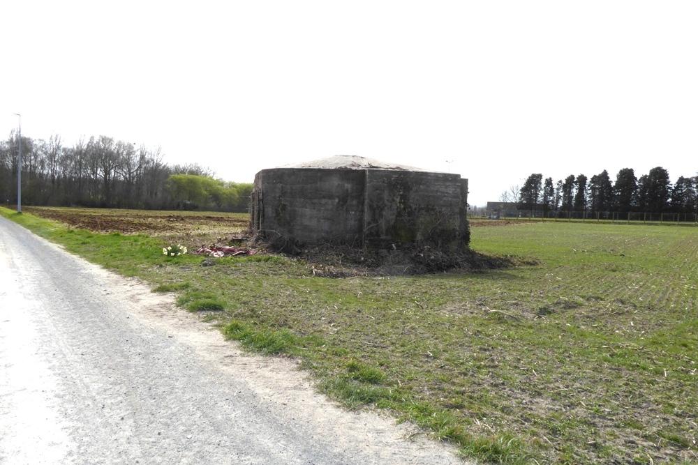
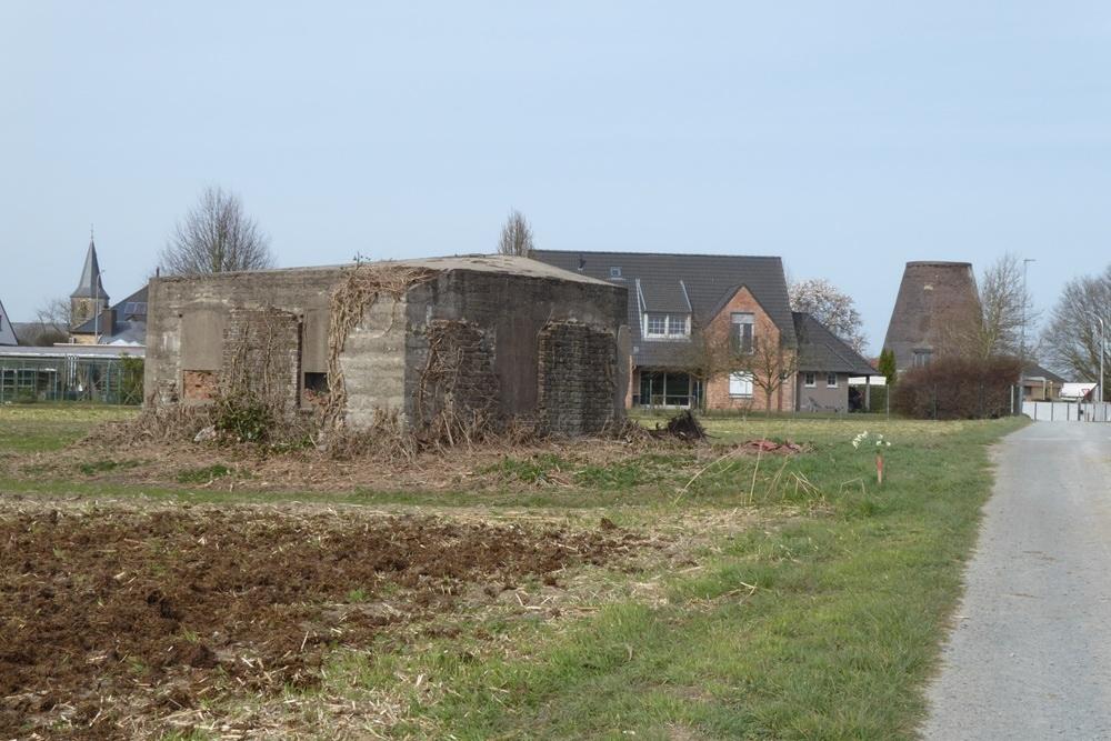
Se11 was a front line bunker on the right side of the Semmerzake strongpoint between Se6 (265 m) and Se7 (255 m), placed at an angle with the Se10 support line bunker (190 m) so that together they had a larger field of view and shooting range towards the south-eastern fields.
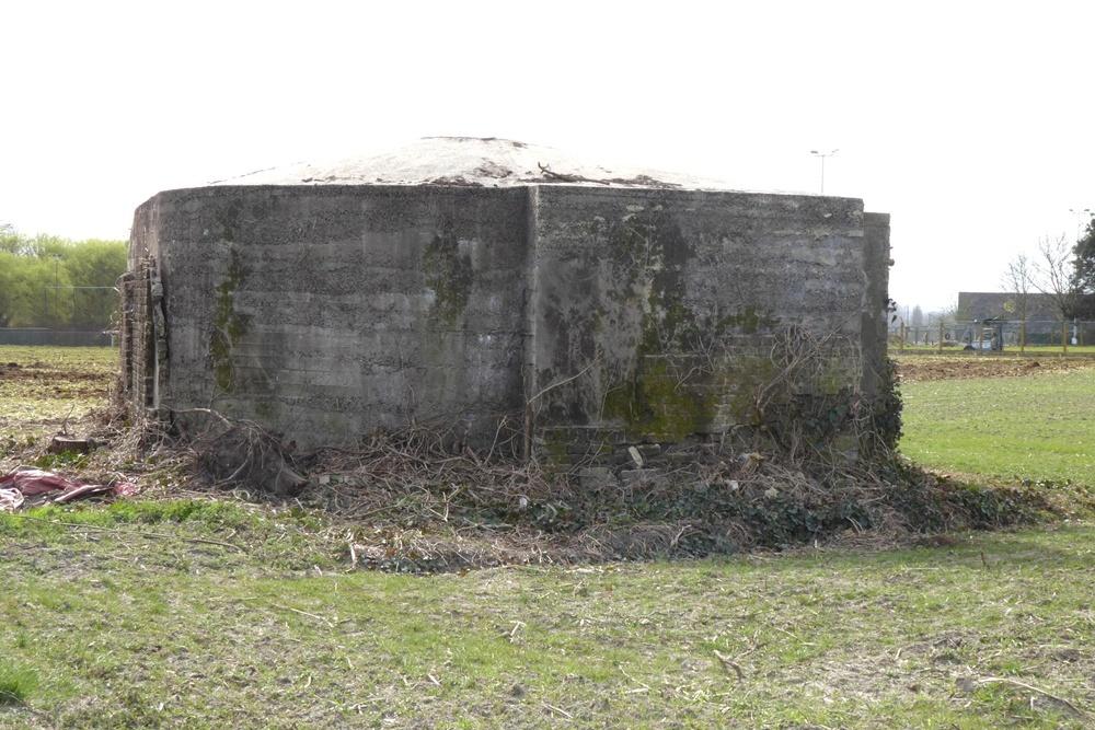
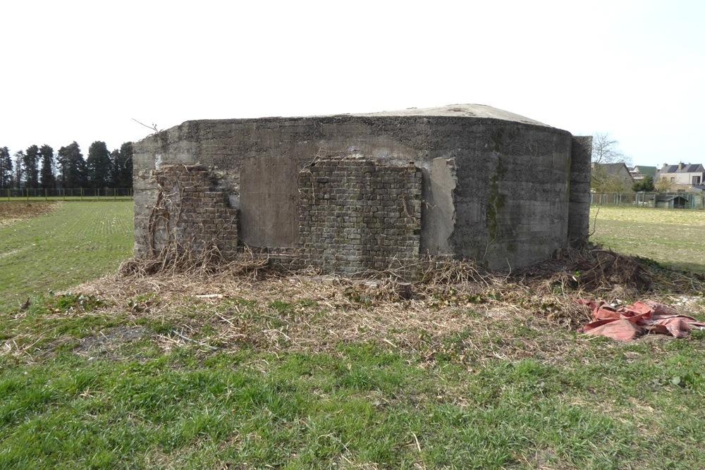
The bunker was originally completely walled with bricks, it was provided with a fairly flat hipped roof because of the dome. The roof covering consisted of red Boom roof tiles.
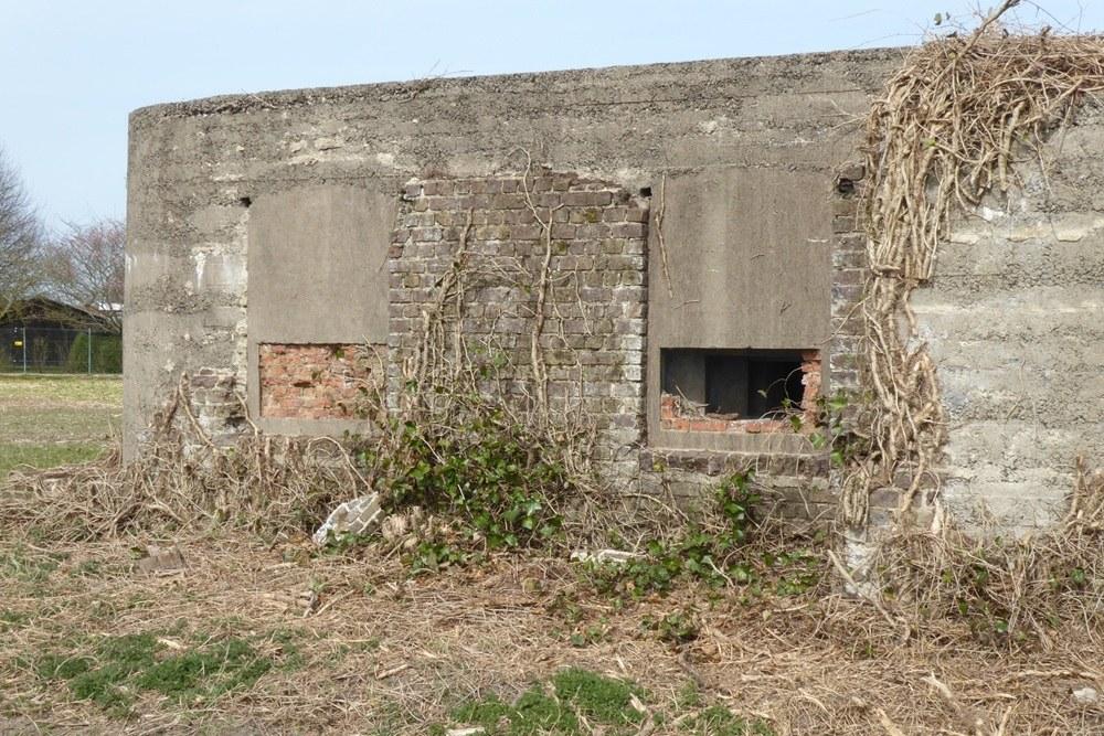
The two loopholes were hidden behind metal shutters, in addition there were four identical false windows. It looked like a small house.
The bunker consisted of two rooms connected at the back and an access sash.
At the back of the second room there was a staircase to the observation dome. From this dome a voice carrier tube with a funnel-shaped end departed to be able to pass on orders to the machine gunners.
It was equipped as standard for Maxim machine guns but also to set up Hotchkiss or Colt machine guns. The bunker is located along a field path and is clearly visible in the field.
Extensive information about this bunker belt can be found on the site Bunkergordel Bruggenhoofd Gent. It also contains photos, plans and technical data of the bunkers. A map shows the locations per municipality.
Do you have more information about this location? Inform us!
Source
- Text: Traces of War
- Photos: Marie-Christine Vinck


Nearby
Point of interest
- Information Board Battle of Gavere Semmerzake - Semmerzake (Gavere)
- Remains Eiserne Halle Scheldewindeke - Scheldewindeke (Oosterzele)
Monument
- Memorial Battle of Gavere - Semmerzake (Gavere)
- War Memorial Semmerzake - Semmerzake (Gavere)
- War Memorial Cemetery Gavere - Gavere
Cemetery
- Belgian War Graves Semmerzake - Semmerzake (Gavere)
- Commonwealth War Grave Gavere - Gavere
- Belgian Graves Veterans Gavere - Gavere
Remembrance Stone
- Stumbling Stone Kortrijksesteenweg 890 - Gent
- Stumbling Stone Monterreystraat 63 - Gent
- Stumbling Stone Fortlaan 93 - Gent
Fortification
Looking for reliable information or news facts about WW2? Do you want to create your own battlefield tour to sights of wars from the past? Or are you interested in war medals and their recipients? TracesOfWar.com tells you more!
More information

© STIWOT, 1999-2025. All rights reserved. Privacy statement, cookies, disclaimer and copyright