Liberation Route Marker 083: Bombing the Dike
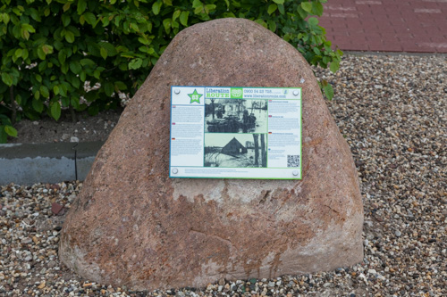
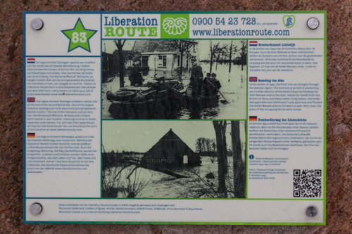
Bombing the Dike
In the winter of 1944, the front line ran straight through the Betuwe region. The Germans planned on preventing any further advance of the Allied troops by flooding the Over-Betuwe area to the east. Helped by bombs from the British air force and these newly rising waters, the badly-damaged dike near Ommeren finally gave way and flooded the Neder-Betuwe area to the west as well. With that, the plans of the occupying forces were ruined.
When, on December 2nd 1944, the Germans blew up the dike on the Rhine at Elden (Rijndijk), the Over-Betuwe area flooded quickly. This forced the Allies to abandon some of their positions and consolidate the frontline. According to the Germans, the dike at Ommeren (Liniedijk) should have functioned more like a dam, preventing the water around the frontline near Arnhem from ebbing away. However, the plan did not work, and the enormous pressure cracked the dike in various places, flooding the Neder-Betuwe area as well.
On the morning of Sunday, December 10th, Typhoons from the 193rd Squadron of the Royal Air Force, took off from Deurne Airport in Antwerp with so-called 1000-pounders hung under their wings. The pilots had been given orders to bomb the partially-collapsed dike in Ommeren so that even more water would flood the Neder-Betuwe, but the manoeuvre had little effect as large parts of the area were already under water.
The war in the Betuwe region crumbled into an amphibious nightmare. The frontline positions were the last pieces of dry land, and soldiers patrolled in canvas boats in cold and soggy surroundings. Meanwhile, the situation for the civilian population became increasingly desperate; houses were flooded and food was scarce. The residents of Ommeren and the surrounding area had to find shelter and food on higher ground whilst the many evacuees staying in the area found themselves in need of refuge for a second time.
Audiospot - Bombing the Dike
Liberation Route Europe is a certified Cultural Route of the Council of Europe. With hundreds of sites and stories in nine European countries, the route links the main regions along the advance of the Allied Forces in 1943-1945.
The entire route consists of themed routes that can be travelled by by hiking, walking, cycling and car. These routes pass numerous historical and interesting sites and tell stories from a multitude of perspectives that were important in the final phase of World War II.
Many routes feature listening spots, offering the opportunity to listen to a historical story at a location. In addition, many ‘Vectors of Memory’ have been placed, indicating that the passer-by is on one of the Liberation Routes.
The routes can be found on the Liberation Route Europe website or in the app through which many stories can also be listened to.
Do you have more information about this location? Inform us!
Source
- Text: TracesOfWar & Liberation Route Europe
- Photos: Arjan Vrieze
Nearby
Point of interest
- Beneden-Leeuwen Commemorates: Tile 01 - the evacuation - Beneden-Leeuwen
- 6.0 km
- Beneden-Leeuwen Commemorates: Dijk 436 - the Mooren sisters home - Beneden-Leeuwen
- 6.1 km
- Beneden-Leeuwen Commemorates: Dijk 432 - Café De Pelikaan - Beneden-Leeuwen
- 6.1 km
Monument
- War Memorial "Ellie Frank" Lienden - Lienden
- 1.7 km
- War Memorial Ingen - Ingen
- 2.2 km
- War Memorial Echteld - Echteld
- 3.7 km
Cemetery
- Commonwealth War Grave Municipal Cemetery Lienden - Lienden
- 1.6 km
- Dutch War Graves Municipal Cemetery Eck en Wiel - Eck en Wiel
- 3.5 km
- General Cemetery Elst - Elst
- 4.7 km
Remembrance Stone
- Stumbling Stones Ambachtstraat 7 - Ochten
- 6.1 km
- Stumbling Stone Sint Josephstraat 9 - Tiel
- 6.9 km
- Stumbling Stones Plein 3 - Tiel
- 7.4 km
Fortification
- Kolff-Casemate 1 Boveneindsestraat 20 - Kesteren
- 5.6 km
- Kolff-Casemate 2 Boveneindsestraat 19 - Kesteren
- 5.8 km
- Kolff-Casemate 3 Boveneindsestraat 23 - Kesteren
- 6.0 km


