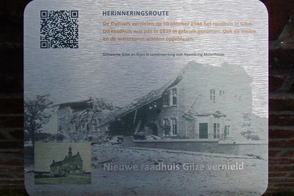
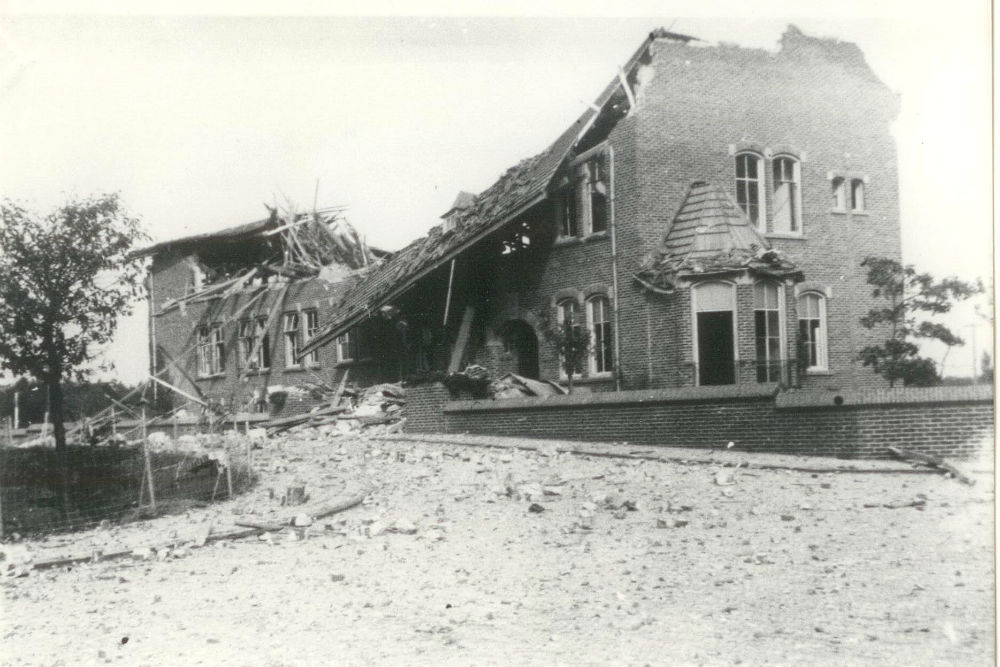
Memory Route World War ll City Hall Gilze Blowing Up
In the Municipality of Gilze and Rijen is a memory route created in memory of the Second World War.
In a number of places there is a sign with a description of what happened at that place in the Second World War.
COUNTRY HOUSE INFLATED IN GILZE
The new town hall on Nerhoven was opened in June 1939. The town hall was designed by architect ir. A. Siebers. He had also developed urban plans for the municipality from the mid-1930s. In these plans it was assumed that the two villages would be built towards each other. Large expansion plans were planned for Gilze on the north side of the village. However, due to the war, plans were largely abandoned. The occupier closed the connecting road between Gilze (end of Nieuwstraat) and Rijen (extension of Julianastraat). Molenheide airfield and Nerhoven airfield, which was developed in the 1930s, were connected to each other and further developed into one of the largest airfields in Western Europe during the Second World War.
Do you have more information about this location? Inform us!
Source
- Text: TracesOfWar
- Photos: Peter van Hoek (1), Heemkring Molenheide (2)
- www.heemkringmolenheide.nl
Nearby
Point of interest
- Memory Route World War ll V2 Fell in the Ridderstraat in Gilze - Gilze (Gilze en Rijen)
- Memory Route World War ll German Bomber Crashed Gilze - Gilze (Gilze en Rijen)
- Memory Route World War ll Hudson Bomber crashed at Warande in Gilze - Gilze (Gilze en Rijen)
Monument
- Liberation Route Marker 142: But this airfield brought disasters… - Gilze (Gilze en Rijen)
- Bell Seat - Liberation Memorial Roman Catholic Cemetery Gilze - Gilze (Gilze en Rijen)
- Chapel Air Raid Shelter Gilze - Gilze (Gilze en Rijen)
Cemetery
- Commonwealth War Graves Roman Catholic Cemetery Gilze - Gilze (Gilze en Rijen)
- Collective Grave Civilian Casualties Roman Catholic Cemetery Gilze - Gilze (Gilze en Rijen)
- Graves Civilian Victims Catholic Cemetery Hulten - Hulten (Gilze en Rijen)
Remembrance Stone
- Stumbling Stone Hoogstraat 80 - Oosterhout
- Stumbling Stone Klappeijstraat 46 - Oosterhout
- Stumbling Stone Leijsenhoek 73 - Oosterhout
Fortification
- Remains Fliegerhorst Gilze-Rijen - Hulten
- Remnant Bunker Airport Gilze Rijen - Molenschot (Gilze en Rijen)
- Remnant Bunker Airport Gilze Rijen - Molenschot (Gilze en Rijen)


