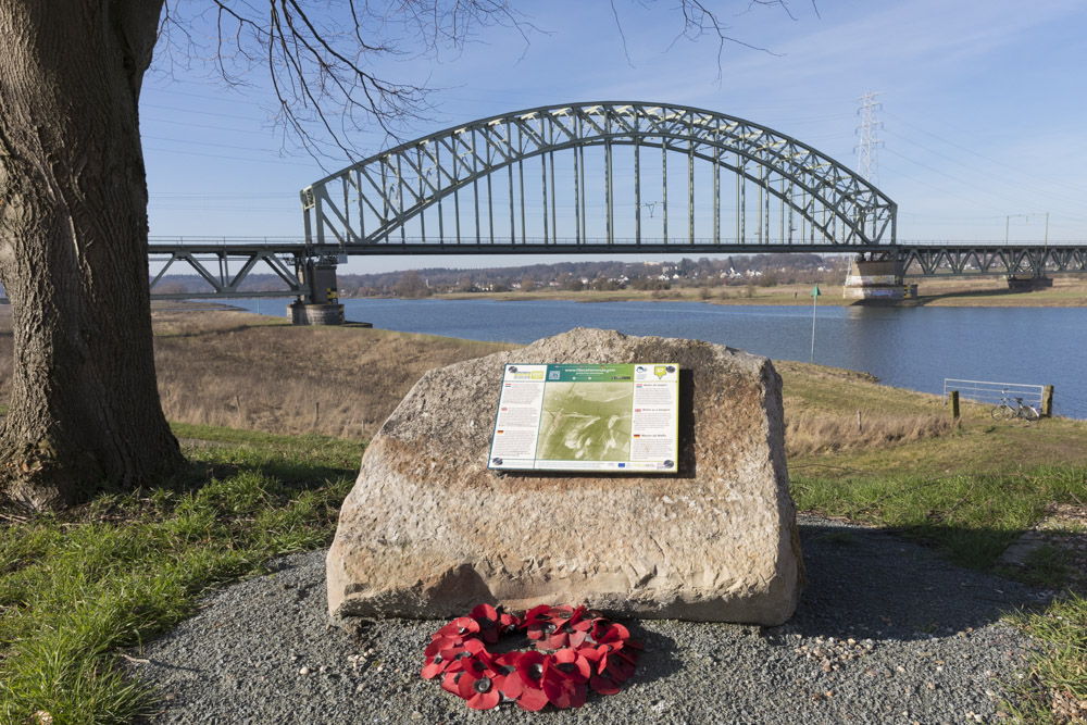
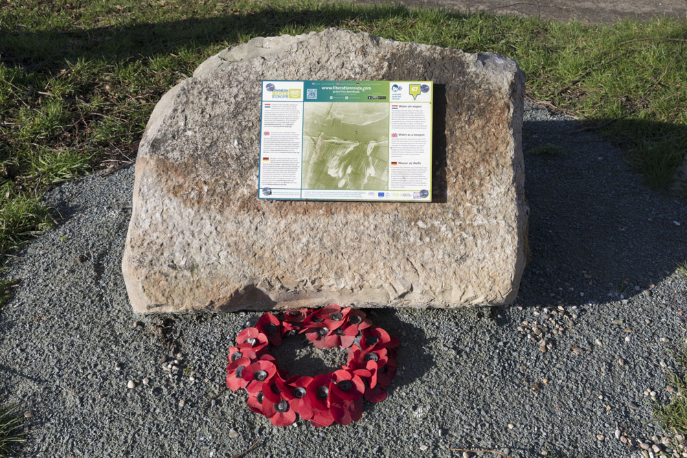
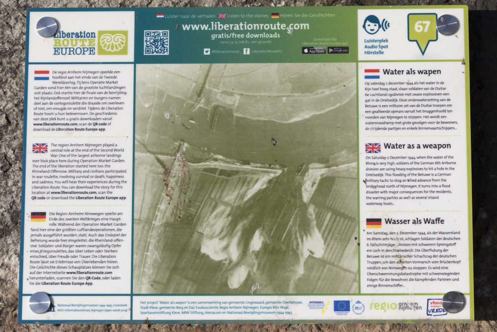
Liberation Route Marker 067: Water as weapon
Water as weapon
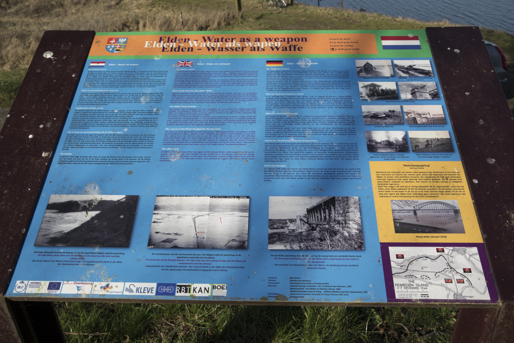
In the autumn of 1944, the high water and the Rhine reached a water level of 12.15 meters above the Amsterdam Ordnance Datum. Saturday 2 December is, therefore, a perfect moment for soldiers of the German 6th Airborne Division to use heavy explosives to blow up the Rhine dyke near Elden. The rising water finds its way through a 100-metre hole in the dyke and flows into the Betuwe.
The German military move with the code name Fallstorch (Operation Stork) aims to stop an allied advance from the bridgehead north of Nijmegen. A partly successful, but mainly risky operation in which the water itself forms an enemy on the battlefield.
Blowing up the dyke and the ensuing floods force the allied troops to abandon certain positions. The large scale of the floods soon become apparent. On Sunday 3 December, the Allies launch a large-scale evacuation of the Betuwe—code name Operation Noah. During this water-war the English travel in storm boats and amphibious vehicles such as the Weasel and DUKW. The Germans move around in Schwimmwagen, canvas Faltboten, rubber dinghies, canoes and other confiscated material.
Around Christmas the water level drops, and ice forms. The high water in February 1945 causes a second flooding. This one also jeopardizes the German line of defense. Every effort is made to close the hole in the dyke. Inland vessels are used as caissons, but the current is so strong that the ships end up far inland. Shortly after capturing Arnhem, Canadian engineering equipment is used to start the preliminary sealing of the now 225-metre dyke breach. It takes ten days for an emergency dyke to be constructed.
Audiospot - Water as weapon
Liberation Route Europe is a certified Cultural Route of the Council of Europe. With hundreds of sites and stories in nine European countries, the route links the main regions along the advance of the Allied Forces in 1943-1945.
The entire route consists of themed routes that can be travelled by by hiking, walking, cycling and car. These routes pass numerous historical and interesting sites and tell stories from a multitude of perspectives that were important in the final phase of World War II.
Many routes feature listening spots, offering the opportunity to listen to a historical story at a location. In addition, many ‘Vectors of Memory’ have been placed, indicating that the passer-by is on one of the Liberation Routes.
The routes can be found on the Liberation Route Europe website or in the app through which many stories can also be listened to.
Do you have more information about this location? Inform us!
Source
- Text: TracesOfWar & Liberation Route Europe
- Photos: Arjan Vrieze
Nearby
Museum
- Airborne Museum 'Hartenstein' - Oosterbeek
- Information Centre: The Poles of Driel - Driel
- Airborne at the Bridge - Arnhem
Point of interest
- Railway bridge Oosterbeek - Oosterbeek
- Battle Marker Gronert Twins and Bakhuis-Roozeboom - Oosterbeek
- Railroad-viaduct Oosterbeek - Oosterbeek
Monument
- Tree to commemorate Jack Baskeyfield - Oosterbeek
- Memorial Crossing Location Operation Berlin - Oosterbeek
- Memorial Royal Engineers and Royal Canadian Engineers Driel - Driel
Cemetery
- War Grave Goossen Family - Arnhem
- Field Graves Polish Soldiers - Oosterbeek
- Commonwealth War Graves Municipal Cemetery North and South Oosterbeek - Oosterbeek
Remembrance Stone
- Stumbling Stones Noordelijke Parallelweg 69 - Arnhem
- Stumbling Stone Amsterdamseweg 155 - Arnhem
- Stumbling Stones Betuwestraat 12a - Arnhem
Fortification
- Concrete Encased M4 Sherman Tanks Meinerswijk - Arnhem
- Concrete Encased M4 Sherman Tank - Arnhem
- Concrete Encased M4 Sherman Tank - Arnhem
