Vector of Memory: Freedom Museum

Freedom Museum
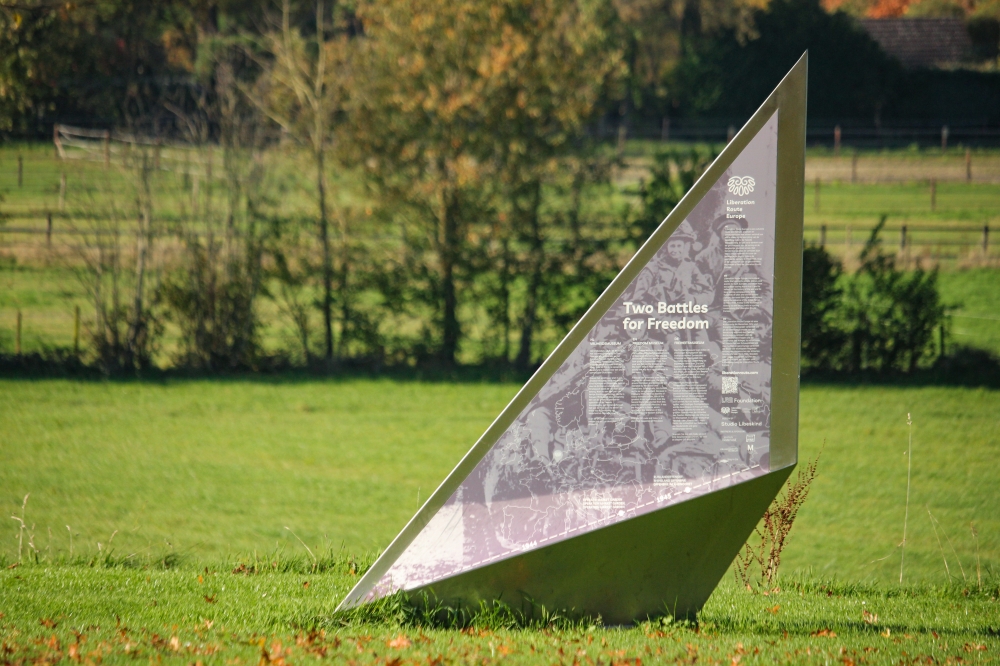
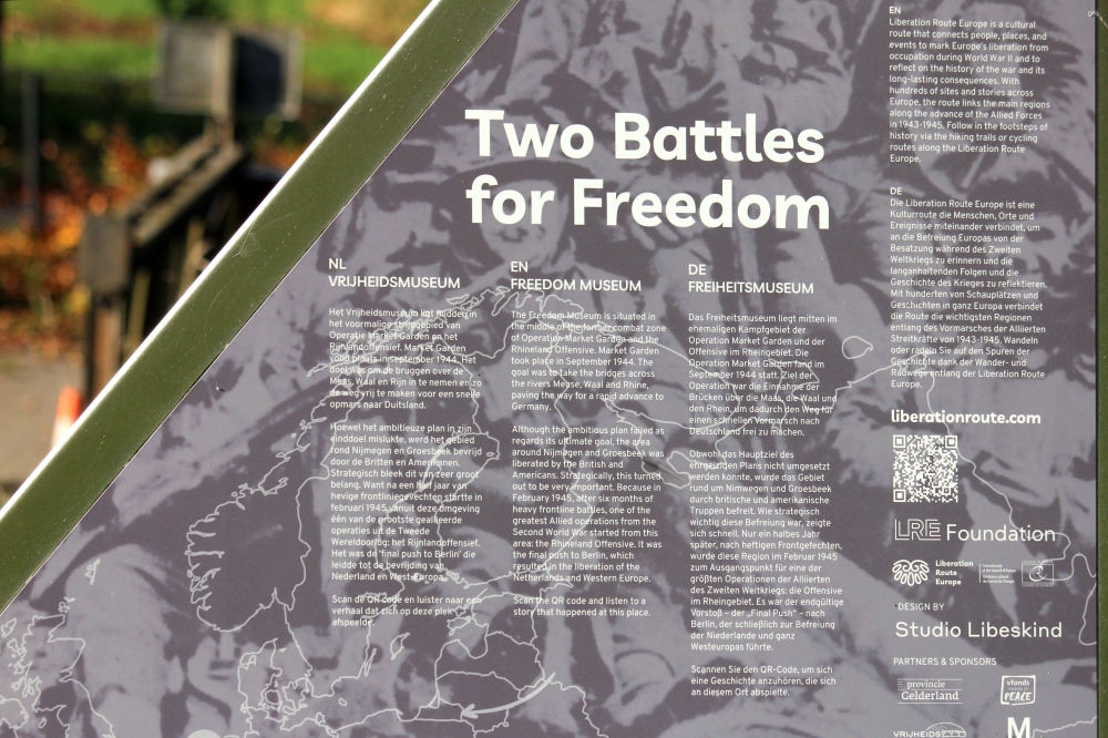
The Freedom Museum is situated in the middle of the former combat zone of Operation Market Garden and the Rhineland Offensive.
Market Garden took place in September 1944. The goal was to take the bridges across the rivers Meuse, Waal and Rhine, paving the way for a rapid advance to Germany. Although the ambitious plan failed as regards its ultimate goal, the area around Nijmegen and Groesbeek was liberated by the British and Americans. Strategically, this turned out to be very important. Because in February 1945, after six months of heavy frontline battles, one of the greatest Allied operations from the Second World War started from this area: the Rhineland Offensive. It was the final push to Berlin, which resulted in the liberation of the Netherlands and Western Europe.
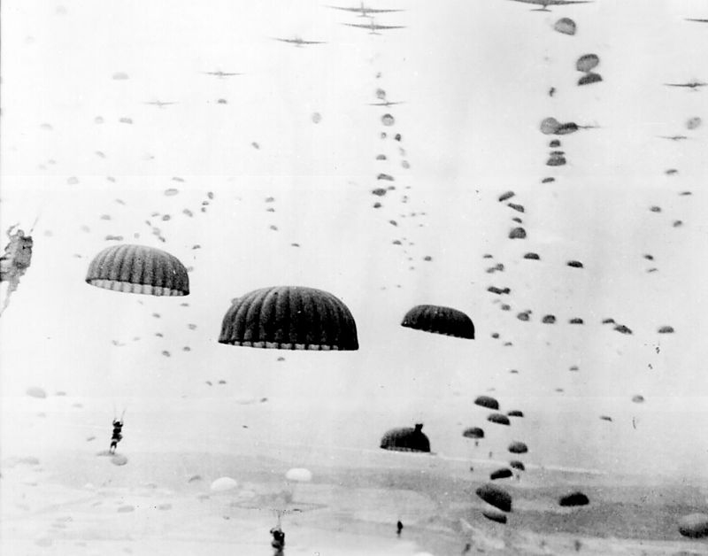
17th September 1944 saw the start of Operation Market Garden and, with it, the Battle of Arnhem. The Allies lost this battle, but the area around the city of Nijmegen was liberated, and the struggle for the city itself was won on 20th September 1944. However, for six long months, Nijmegen and the surrounding area subsequently found itself on the frontline and under continuous attack from German bombs and grenades.
Likewise, despite having been liberated on 17th September 1944, the area around Groesbeek soon became the target of terrible attacks from Kleve and the German Reischswald. Throughout the autumn of 1944, a total of 30,000 people were evacuated from Groesbeek and the surrounding villages. A farm in no man's land is a story about what happened at Groenendaal Farm on Wylerbaan Road.
During the long winter of 1944-1945, the frontline barely moved from its position between the Maas and Rhine rivers, extending from Mook, through Groesbeek and Wyler on to Erlecom. Then finally, on 8th February 1945, Operation Veritable made a dramatic push that would ultimately result in the liberation of The Netherlands and western Europe. The mammoth Rineland Offensive had begun, and it started in Nijmegen.
Audiospot - A farm in No man's land
Liberation Route Europe is a certified Cultural Route of the Council of Europe. With hundreds of sites and stories in nine European countries, the route links the main regions along the advance of the Allied Forces in 1943-1945.
The entire route consists of themed routes that can be travelled by by hiking, walking, cycling and car. These routes pass numerous historical and interesting sites and tell stories from a multitude of perspectives that were important in the final phase of World War II.
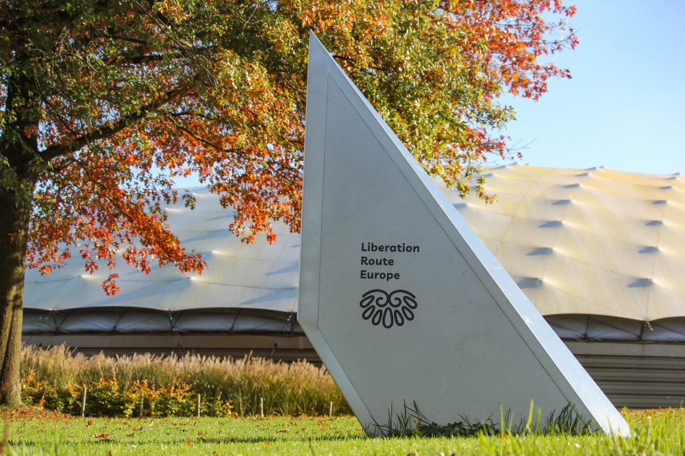
A separate group within the routes are the Vectors of Memory designed by renowned architect Daniel Libeskind. They form a symbolic family of landmarks that honor people, places and stories in the European landscape. The vectors are a topography of memory. They act as points in both space and time and connect to the liberation story. It is important that the markers convey a clear and powerful message.
There are 4 types of vectors:
- The Remembrance Site Vector
- The Crossroads Vector
- The Wall Vector
- The Floor Vector
For more information on the Vectors of Memory see the Liberation Route Europe site: https://www.lre-foundation.org/vectors-of-memory/.
The routes can be found on the website of Liberation Route Europe or in the app through which many stories can also be listened to.
The routes can be found on the Liberation Route Europe website or in the app through which many stories can also be listened to.
Do you have more information about this location? Inform us!
Source
- Text: TracesOfWar & Liberation Route Europe
- Photos: Liesbeth Blogt
Related books


Nearby
Museum
- Freedom Museum - Groesbeek
- 0.1 km
- Museum Remember September 1944 - Mook
- 5.3 km
- Infocentre WW2 Nijmegen - Nijmegen
- 8.3 km
Point of interest
- Villa Vogelsangh Groesbeek - Groesbeek
- 0.7 km
- Information Sign former Monestary Mariendaal Groesbeek - Groesbeek
- 0.8 km
- Concrete Practice Bomb Kerkstraat - Groesbeek
- 0.9 km
Monument
- Memorialpark Canada-The Netherlands - Groesbeek
- 0.1 km
- Liberation Route Marker 039: A farm in No man's land - Groesbeek
- 0.1 km
- M4A1(75) Grizzly Tank "Robin Hood" (Sherwood Rangers Memorial) - Groesbeek
- 0.1 km
Cemetery
- Dutch War Graves Dutch Reformed Churchyard Groesbeek - Groesbeek
- 0.9 km
- Groesbeek Memorial Canadian War Cemetery Groesbeek - Groesbeek
- 1.4 km
- Canadian War Cemetery Groesbeek - Groesbeek
- 1.4 km
Remembrance Stone
- Stumbling Stone Rijksweg 173 - Mook
- 5.2 km
- Stumbling Stone Rijksweg 128 - Mook
- 5.2 km
- Stolpersteine De Hove 13 / 15 (former A 59) - Mook
- 5.5 km
Fortification
- Trenches on Pyramid Hill - Milsbeek
- 5.3 km
- Maas-line - Casemate 115S - Katwijk (Cuijk)
- 5.8 km
- Maas-line - River Casemate South - Katwijk (Cuijk)
- 5.8 km
Crash site
Looking for reliable information or news facts about WW2? Do you want to create your own battlefield tour to sights of wars from the past? Or are you interested in war medals and their recipients? TracesOfWar.com tells you more!
More information

© STIWOT, 1999-2025. All rights reserved. Privacy statement, cookies, disclaimer and copyright